Collector labeling
How Precise Should an Obsidian Locality Be on a Label
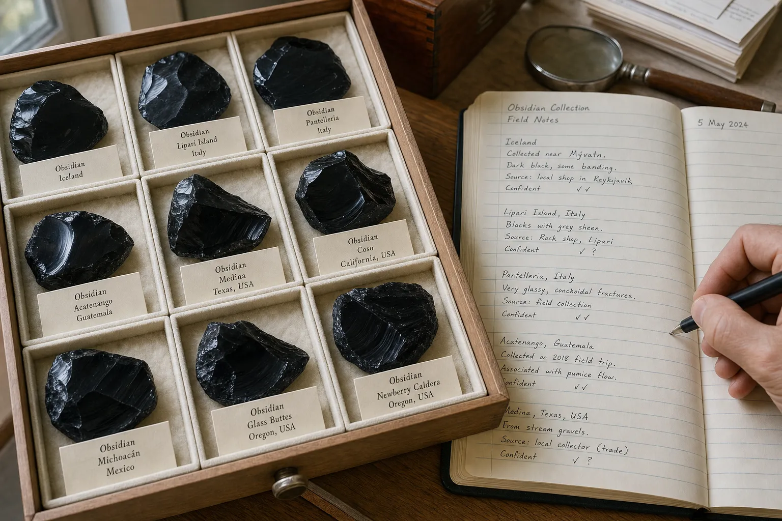
An obsidian locality label should be as precise as your evidence can honestly support. In practice, that means using a clear place name on the visible label, keeping broader wording when that is all you know, and saving fuller notes in your collection record.
A label that says “Oregon, USA” may feel less satisfying than one naming a flow, pit, or roadcut. But it is better than turning a vague seller tag into a specific obsidian locality that the specimen’s records do not actually support. Good obsidian locality precision is not about sounding exact. It is about preserving what is known, what is claimed, and what remains uncertain.
Short answer
Use the most precise supported place on the visible label, and keep technical detail, sources, coordinates, and uncertainty in the collection record.
upward
Read the full overview first
Use the broader guide first if you need the full scope before this page.
Use the Most Precise Supported Place
A useful obsidian label has two jobs: it should help you recognize the specimen, and it should avoid overstating the locality.
For a small display label, the clearest format is usually a simple hierarchy:
- Obsidian variety or description
- Most precise supported locality
- Broader region or country, if helpful
- Short uncertainty note, if needed
A “supported place” is the finest locality level tied to the specimen by a label, field note, acquisition record, catalog entry, or other documentation. It is not simply the most detailed name you can find online.
That distinction matters because obsidian is often sold with attractive locality language. Some names may refer to real collecting areas, volcanic fields, regional sources, or trade shorthand. Still, a market name should be recorded as a claim unless the specimen’s documentation supports more.
Keep the Label Readable, Keep the Record Fuller
A small label cannot carry every useful detail. The display label should be clear enough to identify the piece in a tray, cabinet, or inventory. The fuller collection record can hold the information that protects the label’s meaning later.
For an obsidian specimen, the record may include:
- Original locality wording from the tag, seller note, field bag, or inherited label
- Source of the locality claim, such as seller, collector, field note, catalog, or previous owner
- Date acquired or recorded, if known
- Broad locality and more specific locality as separate notes
- Coordinates, if they were actually supplied or recorded
- Coordinate uncertainty, especially if the coordinates were interpreted or approximate
- Notes such as “seller-provided,” “old label,” “reported as,” or “locality unverified”
- Access caveats, if the locality came from field-collecting notes
This split prevents two problems. First, the visible label stays readable. Second, uncertainty does not disappear. A display tag that says “Obsidian — Nevada” may be enough for viewing, but a record that preserves “old label reads ‘Nevada obsidian, purchased 1990s, no exact source’” is much more useful later.
Collection-data standards often separate locality text, coordinates, and coordinate uncertainty. That idea is helpful even for a simple private collection. A place name is not the same as a map point, and a coordinate is not the same as proof.
Broad Locality Is Sometimes the Best Label
Collectors often feel pressure to make labels more specific. A country, state, or region can look unfinished beside a label with a named mountain, county, quarry, flow, or GPS point. But a broad locality label is sometimes the most accurate choice.
Use broad wording when the finer source is unknown, unsupported, or only implied. “Mexico,” “western United States,” “Oregon,” or “Armenia” may feel incomplete, but those labels are honest if that is all the specimen’s documentation supports.
Broad wording is especially appropriate when:
- The specimen came with only a country, state, or region
- The seller used a general trade locality without supporting detail
- The original tag is damaged, abbreviated, or partly unreadable
- The piece came from an inherited collection with no field notes
- Similar-looking obsidian occurs in more than one area
- The exact source was inferred from appearance alone
Appearance can help you describe a specimen, compare varieties, and decide what questions to ask. Color, sheen, inclusions, polish style, and fracture can support identification work. They usually cannot turn a broad locality into a documented site.
“Black obsidian — probable Mexico, seller label; exact locality unverified.”
That wording gives a working locality, names the source of the claim, and keeps uncertainty visible.
Where False Precision Creeps In
False precision happens when a label looks more exact than the evidence behind it. It often starts with small upgrades.
A seller tag says “Oregon,” and the later record becomes “Glass Buttes.” A collecting area becomes a named pit. A named locality becomes a coordinate copied from a map. A coordinate gains several decimal places even though the original information was only regional. Each step may look more complete, but it can make the specimen less accurately labeled.
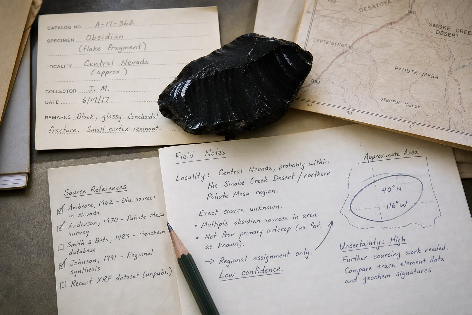
Coordinates deserve particular care. Decimal coordinates look authoritative because they point to a precise spot on a map. But a coordinate may be recorded at the collecting spot, estimated from a place name, copied from an online locality page, or assigned to the center of a broader area. Without an uncertainty note, the number may imply more confidence than the record deserves.
A practical approach
- If the coordinate was recorded at the collecting spot, keep it in the record with any uncertainty note.
- If the coordinate was interpreted from a named locality, say so.
- If only a broad locality is known, do not create an exact coordinate for the label.
- If a coordinate represents a general area, do not treat it as the specimen’s exact source.
For display labels, coordinates are usually unnecessary. They can be valuable in private records, but they are not automatically clearer than plain locality text.
How Specific Is Specific Enough?
The right level depends on the evidence and on how the label will be used.
For a display cabinet
Concise wording may be enough: “Rainbow obsidian — Glass Buttes area, Oregon, USA.”
For a private inventory
The record can be fuller: “Original label: ‘Rainbow obsidian, Glass Buttes, OR.’ Acquired from seller in 2024. Exact flow or pit not stated. Coordinates not supplied.”
For resale or transfer
The wording should avoid giving the next owner more certainty than the record supports: “Locality given by seller as Glass Buttes area, Oregon; no independent verification or exact collecting site documented.”
For a field-collected piece
The record can be more specific if the collector actually recorded the place: “Obsidian — [specific locality], [region]. Field-collected by owner, date recorded. Coordinates retained in private record with approximate uncertainty.”
These are example wordings, not documented field cases. Their purpose is to show how the same locality information can be handled differently on a display label, a private record, or a transfer note.
A mineral locality hierarchy can move from broad geography to narrower place names: country, state or province, county or district, volcanic field, named locality, flow, pit, roadcut, or collecting site. Not every specimen earns every level. If the record stops at “state,” stop there. If it stops at “area,” do not add a pit. If the original tag gives only a trade name, record it as a claim rather than expanding it into a full locality history.
Locality Is Not Access Permission
A locality label records where a specimen is said to be from. It does not tell you whether collecting is currently allowed there, whether the land is public or private, whether a road is open, or whether a site is appropriate to enter.
Older labels need special caution. A past collector’s tag may name a place that is now restricted, privately owned, protected, closed, or difficult to reach. In U.S. public-land contexts, agencies publish separate rockhounding rules and site restrictions. In other countries or land categories, the same principle applies: locality information is not permission.
Useful access notes should be factual and modest:
- “Old label only; not current access information”
- “Private land status not checked”
- “Public collecting rules need separate verification”
- “Do not use label as directions”
These notes are not legal conclusions. They simply keep a locality label from being mistaken for collecting guidance.
A Short Decision Path
When writing or revising an obsidian label, use the shortest path that keeps both clarity and uncertainty intact.
- 1. Start with the original wording. Photograph, transcribe, or store the old label before rewriting it.
- 2. Identify the source of the locality claim. Was it a field note, seller tag, inherited label, catalog entry, or memory?
- 3. Use the most precise supported locality. If the record supports a named area, use it. If it supports only a region, keep the region.
- 4. Avoid decorative upgrades. Do not add a mine, flow, quarry, pit, roadcut, or GPS point because it sounds more complete.
- 5. Put technical detail in the record. Coordinates, interpreted coordinates, uncertainty notes, and access caveats usually belong in specimen label records, not on a small tag.
- 6. Mark uncertainty plainly. Phrases like “seller label,” “old label,” “reported as,” “exact locality unverified,” or “locality unknown” keep the label honest without making it unreadable.
The Best Label Is Precise Enough
For an obsidian collector, the goal is not to make every label sound like a database entry. The goal is obsidian label clarity: a readable tag that says what is known, and a fuller record that preserves how it is known.
Use a specific obsidian locality when the documentation supports it. Use a broad locality label when broader is all you have. Keep the original locality wording, the source of the claim, and any provenance uncertainty where you can find them again. Treat coordinates as useful record details, not automatic proof. A label that honestly says less is better than one that looks exact but rests on guesswork.
FAQ
Should every obsidian label include coordinates?
No. Coordinates are usually better kept in the collection record, especially if they are approximate, interpreted, or too detailed for a small display tag. A clear place name with an uncertainty note is often more useful on the visible label.
Can appearance prove an exact obsidian locality?
Usually not. Appearance can help with description and comparison, but similar-looking obsidian can occur in more than one place. Use visual traits as clues, not as proof of a specific source.
Is a seller locality enough to put on a label?
It can be enough if you word it clearly. “Seller label says…” or “locality given by seller as…” preserves the claim without presenting it as independently confirmed.
Should I replace an old vague label with a more specific modern name?
Only if you have documentation that supports the update. Otherwise, keep the old wording in the record and use a cautious label such as “old label says…” or “exact locality unverified.”